Regional Movements of Reef Manta Rays (Mobula alfredi) in Seychelles Waters
July 2020
Lauren R. Peel, Guy M. W. Stevens, Ryan Daly, Clare A. Keating Daly, Shaun P. Collin, Josep Nogués & Mark G. Meekan
Keywords: Spatial Ecology • Acoustic Telemetry • Satellite Telemetry • Geolocation • Western Indian Ocean • Conservation
Summary: Improved understanding of the spatial ecology of reef manta rays (Mobula alfredi) is crucial for designing effective conservation strategies. This study used satellite tags, acoustic tags, and photo-identification techniques to investigate manta ray movement patterns in the Seychelles. Manta rays were observed across six of the seven Island Groups in Seychelles, with some individuals being resighted over several years. Satellite tracking revealed that manta rays primarily stayed within the Seychelles Exclusive Economic Zone, spending most of their time near the Amirantes Bank. The findings emphasize the importance of D'Arros Island, St. Joseph Atoll, and the wider Amirantes Group for manta rays in the Seychelles, informing future conservation efforts in the region.
Abstract
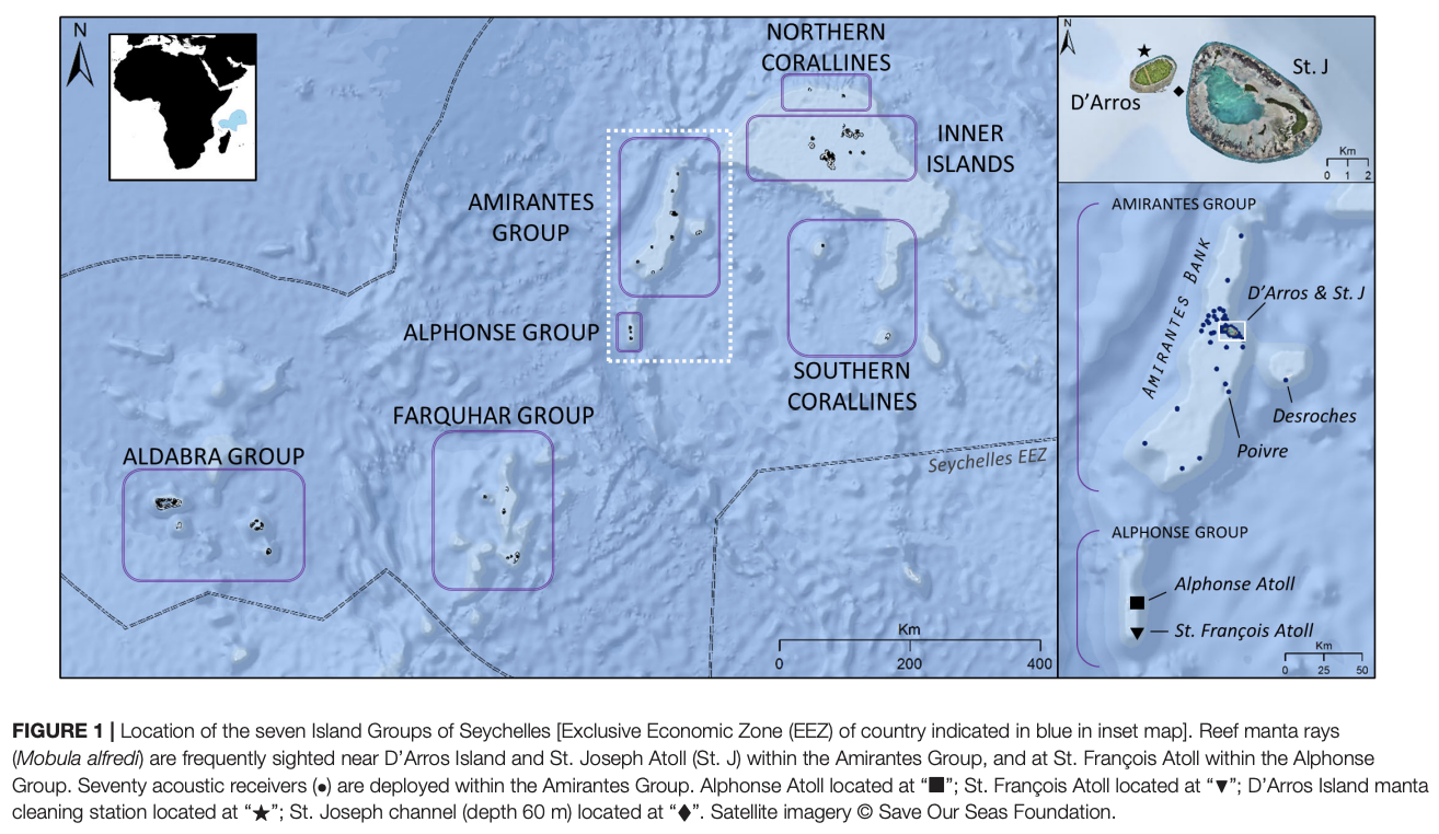
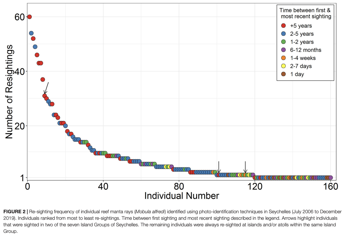
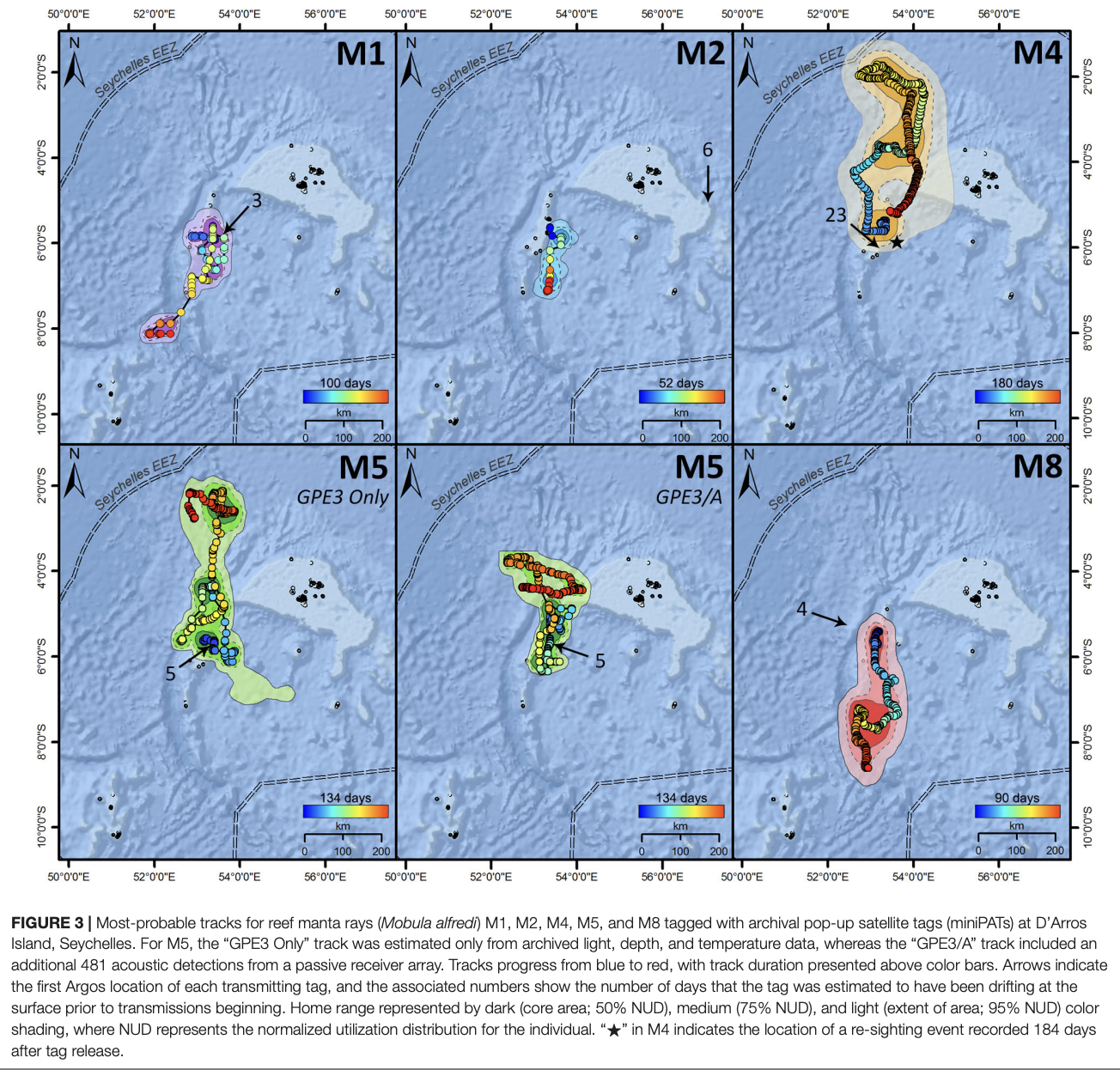
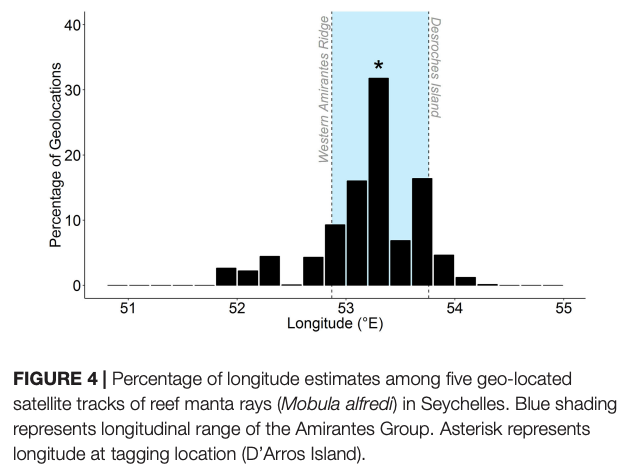
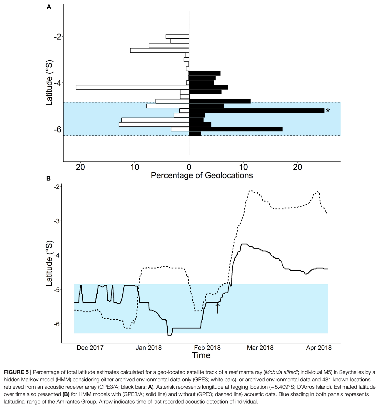
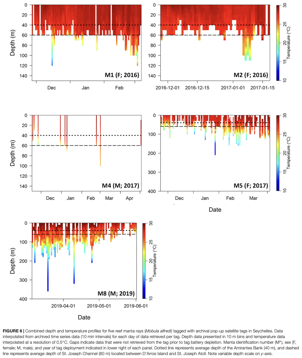
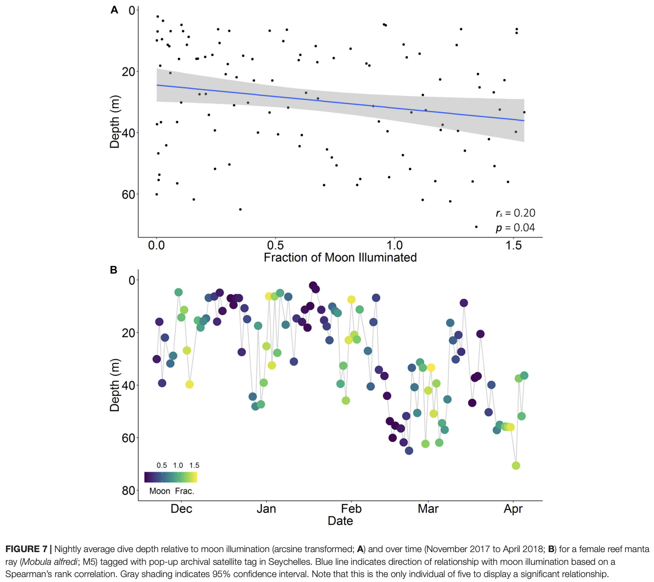
“The decline in numbers of reef manta rays (Mobula alfredi) throughout their range has highlighted the need for improved information on their spatial ecology in order to design effective conservation strategies for vulnerable populations. To understand their patterns of movement in Seychelles, we used three techniques—archival pop-up satellite tags, acoustic tags, and photo-identification—and focussed on the aggregation at D’Arros Island and St. Joseph Atoll within the Amirantes Group. M. alfredi were photographed within six of the seven Island Groups of Seychelles, with 64% of individuals being resighted at least once between July 2006 and December 2019 over timeframes of 1–3,462 days (9.5 years; median = 1,018 days). Only three individuals from D’Arros Island were resighted at a second aggregation site located more than 200 km away at St. François Atoll during photo-identification surveys. Satellite-tracked M. alfredi (n = 5 tracks; maximum 180 days) remained within the boundary of the Seychelles Exclusive Economic Zone, where they spent the majority of their time (87%) in the upper 50 m of the water column in close proximity to the Amirantes Bank. The inclusion of acoustic tagging data in the models of estimated satellite-track paths significantly reduced the errors associated with the geolocation positions derived from archived light level data. The insights gained into the patterns of horizontal and vertical movements of M. alfredi using this multi-technique approach highlight the significance of D’Arros Island and St. Joseph Atoll, and the wider Amirantes Group, to M. alfredi in Seychelles, and will benefit future conservation efforts for this species within Seychelles and the broader Western Indian Ocean.”
Author Affiliation
School of Biological Sciences, Oceans Institute and Oceans Graduate School, The University of Western Australia
The Australian Institute of Marine Science
The Manta Trust
Save Our Seas Foundation – D’Arros Research Centre
South African Institute for Aquatic Biodiversity
Oceanographic Research Institute
School of Life Sciences, College of Science, Health and Engineering, La Trobe University, Bundoora
Island Conservation Society
Funded by
Save Our Seas Foundation
The Manta Trust
The University of Western Australia
Australian Institute of Marine Science
Island Conservation Society
Alphonse Foundation
Islands Development Company
Blue Safari
Alphonse Island Lodge
UWA Postgraduate Student’s Association